GASGI has announced the production of the official map of the Kingdom of Saudi Arabia, complete with internationally approved borders
12 Sep 2023
News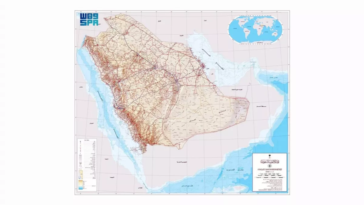
The official map of the Kingdom of Saudi Arabia, complete with internationally recognised borders, has been produced, according to a statement from the General Authority for Survey and Geospatial Information (GASGI). All government agencies, the commercial sector, educational institutions, people, and the media may now access this official map. The map is available on the authority's website in both Arabic and English and in a number of different digital forms. It is possible to get official maps of the Kingdom in a variety of sizes and for various reasons.
The relevance of government organisations that represent the Kingdom in global organisations, conferences, and forums pertaining to geospatial data is emphasised by GASGI. They are asked to provide the event planners with the most recent official kingdom maps. This makes sure that borders between countries on land and at water, as well as islands, are appropriately represented.
In addition, GASGI requests that all government agencies, including those that are legitimate authority and other organisations, refrain from publishing any maps of the Kingdom other than the one that is recognised by the government.
